From West Country correspondent, Mr. Alex Smith:
The Perineum Way: Chipshop to Lifton Seperate and a return with views of Brown Willy.
The trouble with winter cycling on country lanes is the run-off from the fields that turns to bobbly ice as it seeps through the stone walls, seeding your path with little rivers of fuck you as you freewheel your way around blind country corners. It’s probably worse if you see it first. You can’t brake or it will take your front wheel. You have to brake to navigate the corner. Whichever way, you’re in for a new outer skin at best and in all sorts of hospital based drama at worst. That’s why we mostly wait for the thaw to revisit our favourite country lane cycle routes.
This is one that explores that underutilised little strip of land that divides our two favourite playgrounds, Bodmin Moor in Cornwall and Devon’s bleak but beautiful Dartmoor. Situated mostly in the Tamar valley, always below the height of the surrounding moorland with its towering hills and tors and accompanying clitter, we’ve christened this route the Perineum Way. Clitter, by the way, is boulder scree, the softer molten rock that first pushed up through the eruption that formed the tor, weathering over time and rolling down the slopes to leave exposed the saddle of harder rock that gives the tor its classic shape. It is also, according to Google, a cheap vajazzle (Clitter: Body glitter for your vagina).
The day down here on Tuesday was forecast to start brightly, darkening as the rain clouds started to build for an expected evening downpour and an accompanying wind that was predicted to be colder than of late. It pretty much panned out that way. It was dry but misty down in the Tamar Valley and warmer up in the sun. Rain-bearing clouds skirted both sides of us later in the day but ultimately we were rain-free for the whole trip. Ideal, as they say down here.
We parked the car by the pub at Chipshop and made off down the lane to Coombe. First stop was Horsebridge, a traditional pub village on the Tamar, the river being the border between Devon and Cornwall in these parts. Crossing the bridge into Cornwall, and pushing the bikes up the hill to Stoke Climsland, we pedalled on through Bray Shop, Coads Green, Congdon’s Shop and Lewannick, eventually arriving at the picture perfect village of Polyphant where we crossed the Inny, a tributary of the Tamar, at Hicks Mill. I must say at this point that there is no shop at Bray Shop nor at Congdon’s Shop. And there is, unsurprisingly I suppose in the wake of the previous news, no chip shop at Chipshop. These names are all that remain of the practice carried out in times not too past when the mine owners would pay their workers not in cash but chips, redeemable only at shops and public houses in the locality. Indeed, the Copper Penny Inn where we started our trip was once named the Chipshop Inn. There is no river Outy.
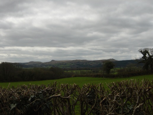
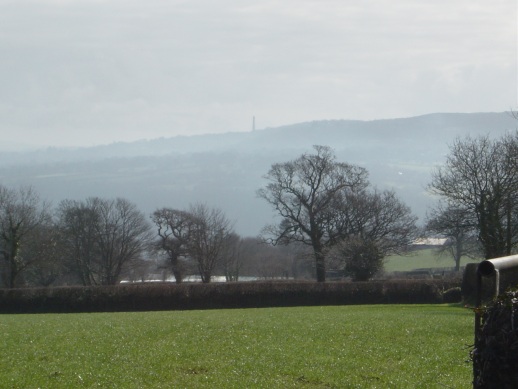
All of the route travelled thus far was in the direction of, and then skirting, the eastern boundaries of Bodmin Moor. The first sighting of historical moorland scenery was of the mine chimney at the top of Kit Hill viewed from Horsebridge, then, later, Caradon Hill and its surrounding moorland and tors and, on reaching more northerly latitudes, Fox Tor, Hendra Downs and the top of Brown Willy and Buttern Hill.
We headed north from here and entered Launceston by the same valley as the Steam Railway, exiting the town on the north bank of the river Kensey (another Tamar trib), before heading for Liftondown, along Darkey Lane and then to Lifton itself. It is here the decision is made to return either by Chillaton or by the less busy Milton Abbot road. We’ve christened this junction the Lifton Seperate, our little homage to Robert Ludlum. We chose some humpback lanes to Chillaton and a straight run down to Chipshop and the car, all the way picking out the Dartmoor landmarks around Mary Tavy and Brentor on our left hand side. The masts at Caradon, on our right hand now, and at North Hessary Tor to our left were both in the same vista now, a little disorienting even though we had often viewed one from the other in the past. Picking out Ger Tor, White Tor and Cox Tor only proved that it is sometimes difficult to recognise even old friends when viewed from an alien angle (insert joke here). Brentor, with its tiny 13th century church perched precariously on top, is recognisable from any angle and therefore a constant frame of reference. Brentor is also the venue most favoured for moody photoshoots by local goth and heavy metal bands. And for young non musicians there’s always the classic Devil finger bunny ears at dusk. Something for everyone there.
The trip was 37 miles in all and quite strenuous in parts. There were still plenty of opportunities to get saddle sore, though, giving us a second, and lasting, reason for naming this great route the Perineum Way. It’s a journey that is endlessly editable, so much so that I don’t think we’ve ever done the whole thing the same way twice. Remember; If you’re thinking of designing yourself a route around here, you really don’t have to go so far as we did. There are some lovely pubs in this area but beware of drinking all your beer in one place, you just might not get any further. And that would be a shame.

